
RATP
Augmented reality visualization and prevention tool for construction work in metro environments
Project Showcase


Project Details
Type
Augmented Reality Visualization Tool
Client
RATP
Platform
AR/Mixed Reality
Status
Completed
Technologies
Point Cloud Processing, AR Development, 3D Visualization
Category
Industrial AR Solution
Target Users
Construction Site Managers
Role
AR Development & Visualization Solution
01Project Overview
We developed an innovative augmented reality visualization and prevention tool for RATP (Paris public transport authority) designed to assist construction site managers working on pipeline infrastructure within metro systems. This cutting-edge solution transforms how construction planning and execution are managed in complex underground environments.
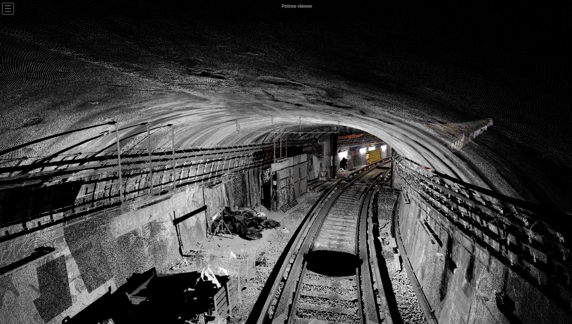
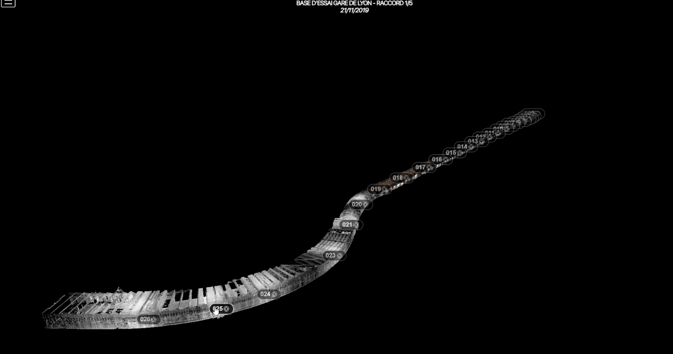
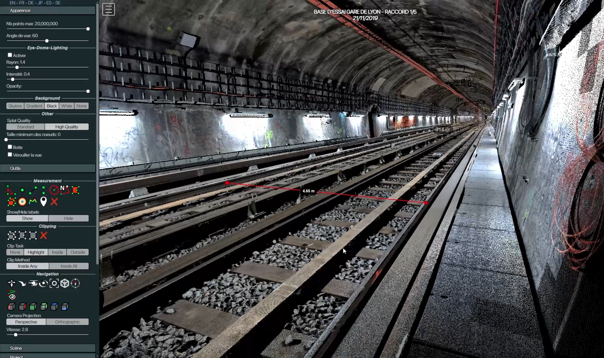
The project involved scanning metro environments using advanced 3D scanning technology to create detailed point clouds, which were then processed to recreate accurate digital environments. This foundation enabled the creation of an AR tool that empowers construction managers to visualize entire systems, take precise measurements, and plan work in advance.
02Key Features
- •3D Point Cloud Processing : Advanced scanning technology was used to capture detailed point clouds of metro environments, creating accurate digital representations of real-world infrastructure.
- •Augmented Reality Visualization : Immersive AR interface allowing construction managers to visualize entire pipeline systems and infrastructure in their actual context.
- •Precise Measurement Tools : Built-in measurement capabilities enabling accurate distance, volume, and spatial calculations directly within the AR environment.
- •Advanced Work Planning : Tools for planning construction work in advance, visualizing potential conflicts, and optimizing workflow before physical work begins.
- •Error Prevention System : Proactive identification of planning errors and potential construction issues before they occur, significantly reducing costly mistakes.
- •Time Optimization : Streamlined planning process that saves significant time by enabling better preparation and reducing on-site decision-making delays.
03Technical Innovation
This project represents a significant advancement in construction management technology, combining state-of-the-art 3D scanning, point cloud processing, and augmented reality to create a comprehensive visualization and planning tool.
The workflow began with on-site scanning operations where specialized teams used 3D scanners to capture detailed point clouds of metro environments. These point clouds were then processed and converted into accurate 3D digital environments that serve as the foundation for the AR visualization tool.
The augmented reality interface allows construction managers to overlay digital information onto the real world, providing an intuitive way to understand complex infrastructure systems, identify potential issues, and plan work more effectively.
04Partnership with RATP
This project was developed in collaboration with RATP, one of the world's largest public transport operators, demonstrating our ability to work with major infrastructure organizations to create innovative solutions for complex operational challenges.
The tool is specifically designed for construction site managers responsible for pipeline infrastructure within metro systems, providing them with advanced visualization and planning capabilities that were previously unavailable.
05Impact and Benefits
This AR visualization tool delivers significant benefits to construction managers and the RATP organization as a whole. By enabling advanced visualization and planning capabilities, the tool helps prevent costly errors and reduces the time required for construction planning and execution.
Key benefits include:
- •Reduced planning errors through advanced visualization and conflict detection
- •Time savings through better preparation and reduced on-site decision-making
- •Improved accuracy in measurements and spatial understanding
- •Enhanced safety through better planning and visualization of work areas
- •Cost reduction by identifying and resolving issues before physical work begins
The tool empowers construction managers to make more informed decisions, plan work more effectively, and execute projects with greater precision and efficiency.
06Technical Implementation
The development of this solution required expertise in multiple advanced technologies including 3D scanning, point cloud processing, 3D reconstruction, and augmented reality development. The project involved processing large datasets from scanning operations and converting them into optimized digital environments suitable for AR visualization.
The AR interface was designed to be intuitive and practical for construction managers, providing essential tools for visualization, measurement, and planning while maintaining performance and usability in challenging metro environments.
The solution integrates seamlessly with existing construction workflows, providing a powerful tool that enhances rather than replaces traditional planning methods, while offering capabilities that were previously impossible without advanced visualization technology.